As Kim and I prepare for our year-long road trip, the question we get most often is, “Where are you going?” My tongue-in-cheek reply? “Everywhere!”
Kidding aside, we really do want to see as much of the United States as possible. This is a huge country (something that residents of other nations don’t always realize), and there’s a lot to see and do. But how can we see it all? Obviously, we can’t — but we could certainly try to optimize our route.
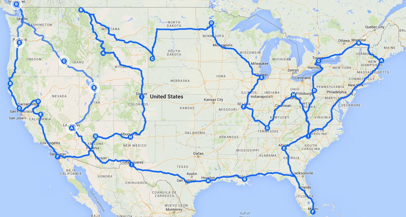
Recently, a Michigan State doctoral student used an algorithm to plan a route for the ultimate road trip across the U.S., charting a course to visit each of the 48 mainland states. Here’s his mathematical map:
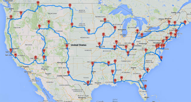
Randal Olson’s optimal road trip to U.S. landmarks
Olson’s route focuses on major landmarks and National Parks. For folks who prefer cities to nature, he also created a second map (which, as you can see, is similar to the first):
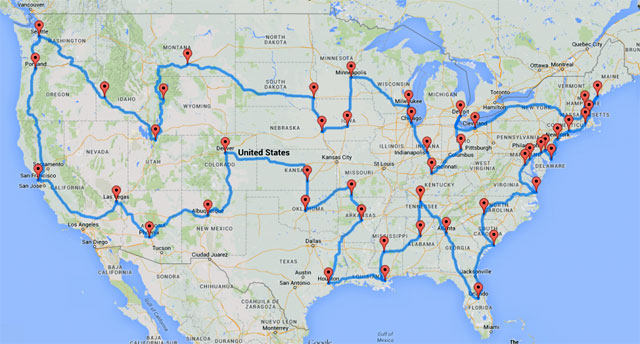
Randal Olson’s optimal road trip to U.S. cities
Perhaps unsurprisingly, Kim and I had a lot of people send us Olson’s maps by Facebook and email last week. “You should do this!” they told us. Maybe. But maybe not.
Layers of Fun
 When we started planning our trip, both Kim and I were taking notes by hand. Whenever somebody invited us to visit or we found an interesting site to visit, we’d jot it down in a notebook. The problem? How to convert these notes to a map. I bought a big paper map of the U.S. While fun to look at, this traditional map seemed awkward and inefficient.
“I wonder if I can create a trip plan with Google Maps?” I wondered. The answer is: Of course! In fact, it’s very easy and efficient to plot points of interest using Google Maps, and then use this information to plan a route.
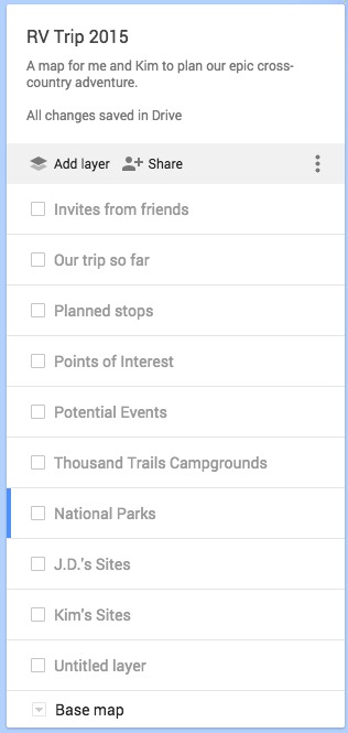
To begin, I opened Google Maps, just as I would when looking to find a local business or restaurant. When I clicked in the search box, I selected “My Maps”. From there, I created a new map called RV Trip 2015. One by one, I created “layers” for each type of stop we’re considering.
- I created a layer for National Parks.
- I created a layer for friends and family.
- I created a layer for RV parks.
- I created a layer for planned stops (such as conferences).
- I created a layer for personal points of interest (such as the Charles Schulz museum).
Next, I began adding items to each layer. I might select the “National Parks” layer, for instance, and then use the search box to find Redwood National Park. I’d then add location pin to the “National Parks” layer. When appropriate, I’d add notes or change the name of the pin to provide more meaningful information. After several weeks of work, we have a map containing a couple of hundred locations.
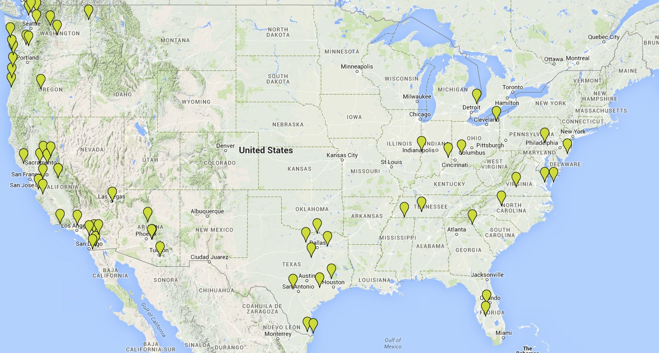
There are invites from friends:
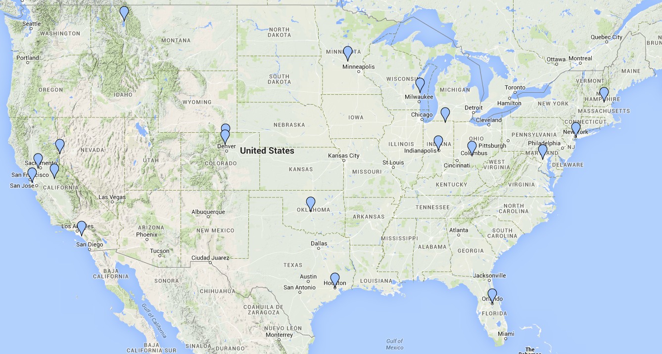
The friends layer in our road-trip map
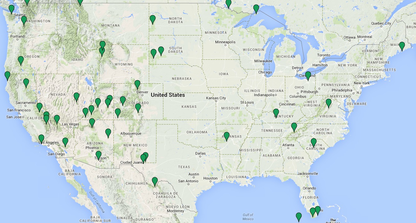
There are RV parks where we can stay free:
The campgrounds layer in our road-trip map
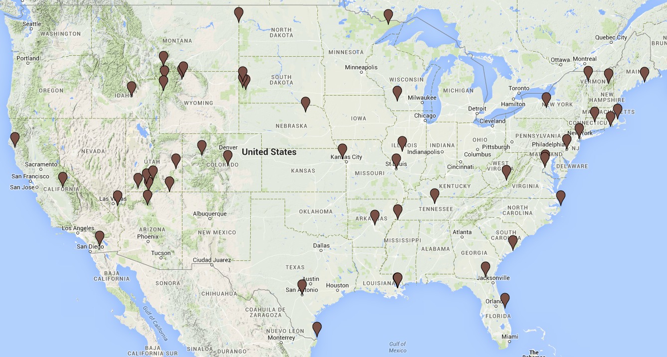
There are National Parks:
The parks layer in our road-trip map
And there are other points of interest:
The points-of-interest layer in our road-trip map
When you put these all together by selecting every layer in the map, you get something that looks like this:
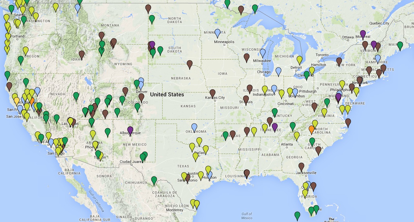
Our master road-trip map
Look at all of those places to visit! And that’s just to start. We know we’ll receive more invites from friends while we’re on the road, and we’ll here about other places to explore.
Setting a Course for Adventure
Putting it all together, then, we’ve come up with a rough idea of our course. Keep in mind, however, that our motto is “go with the flow”. We expect our route to change as we meet new people and find new places that we love. We’re going to make this up as we go along!
Having said that, our rough plan is as follows:
- On March 25th — my 46th birthday — we’ll leave Portland and head south. We’ll probably save Oregon for the end of the trip rather than the start, so we’ll be in northern California by the end of next week.
- We’ll spend the first part of April in northern California, exploring the Redwoods, wine country, and Yosemite. Plus we’ll visit Kim’s friends and family. Toward the end of the month, we’ll move to southern California to do more exploring.
- Next, we’ll explore the American Southwest for a bit before turning north to the Denver area. We have lots of friends and family in Colorado, so we expect to spend a bit of time there before moving on to Yellowstone and Montana.
- After Montana, we’re not exactly sure of our route. We’d both like to peek at Alberta (we’ll have our passports with us), but perhaps we’ll make the trip U.S.-only and travel to the Dakotas.
- In any event, we’ll reach Minnesota by July, where we’ll see several friends. We also have people to see in Wisconsin, Indiana, and Ohio. The summer is up in the air. What will we do? I half suspect we’ll explore Kentucky and Tennessee, but who know?
- We’ll be in Charlotte, North Caroline in mid-September to attend Fincon, the financial blogging conference. After that, we intend to drive to Maine. For the next few weeks, we’ll follow the fall color down the east coast.
- We’ll end up in Florida by mid- to late-October. After that, we’ll make our way west-ish, visiting Atlanta and New Orleans and other sites of interest. Eventually, we’ll reach Houston, where we have other friends we want to see.
- As autumn moves to winter, we’ll start heading home. I expect we’ll revisit some of our favorite places in California and the Southwest before heading back to the Pacific Northwest. It’s my hope that we’ll take some time to explore Washington and Oregon before we return to Portland next spring.
So, that’s the plan — such as it is. If I do a rough map of this plan, I get something that looks like this:
A rough guess of our itinerary
Our rough plan sort of resembles Randal Olson’s optimal U.S. road trip — but only sort of. For us, it’s not about optimization. It’s about the spirit of adventure.
What does the future actually hold for us? Who knows? Maybe we’ll hate the RV and call it quits after just two weeks. I doubt that, however. Somehow I suspect we might take even longer than twelve months to make it back to Portland. Wherever we end up, you can follow all of our adventures here at Far Away Places!
{ 15 comments… read them below or add one }
Sounds like a plan! Any insight into your budget for the year?
You might think about the badlands in Alberta as you venture up near the border. Our Canadian dollar has really plummeted so you’d reap a good deal in exchange, though I do recommend you exchange money in the US. Don’t forget to see Niagara Falls as you go by. Oh, and Sedona, Arizona. It’s a do-not-miss!
Happy trails!
If you do want to consider going into Canada, I can give you some great tips. I live in California now but grew up in an amazing part of BC just across the border from eastern Washington. Feel free to email me, I put my real address.
Google Nelson, BC, Kootenay Lake, could go east through Fernie to Waterton Lakes, the Canadian side of Glacier national park..then reenter the U.S.there.
Looks like a fantastic trip with the right ratios of planning and whimsy! I’m excited for you and Kim and, of course, am looking forward to seeing you along the way. Cheers!
I just want to reiterate my suggestion for visiting the Outer Banks: wild horses, dolphins, turtles, and Brew n Thru. These are all necessary for your enrichment!
The Charles Schultz museum is great – especially if you are a Peanuts geek – and that area of Northern California is beautiful.
If you haven’t already, you might consider checking out the Road Foods website for those small, sometimes-ancient, fantastic places to eat across the country. Or find your own.
Have a great trip.
I think you have to decide what the sights are that you really have to see. Like Yellowstone, Grand Canyon, etc. Then plan your route. Also, try to be flexible. One of the greatest parks is Mesa Verde, near Durango. It has the cliff dwellings that aren’t really any place else in the US. Your map misses them. Also, if you go to Denver, you want to see Pikes Peak, near Colorado Springs. That is Not to Be Missed. Its good that you are skipping Kansas and Nebraska, not much to see there, and you can drive through in a few years. Why don’t you ask your readers what their Not to Be Missed recommendations are? That would be interesting. I’m going to work on a list.
I’m going to have to second the recommendation to see Mesa Verde near Durango. Durango is pretty far off the beaten path, so it’s not one of those places you would ever likely get to if your’re not explicitly driving. But it is really cool, the hike down to the cliff dwellings seems to be something you and Kim would really enjoy.
The cliff dwellings are a for sure stoop for us!
Did you know that you can stay in any Walmart parking lot for free? Security comes around to check on you.
Hi JD – Would definitely welcome you to Boston if you want to swing through on your way to Maine! Plenty of fun history, though you’ll definitely want the Mini for navigating downtown! Please feel welcome to reach out :)
Hey JD – Long time reader here. A couple of suggestions if you’re interested – You’re coming through Western, NY – Depending on the time of the year (Spring-Summer-Fall), Letchworth State Park – the Grand Canyon of the East – is not to be missed and has plenty of camper spots. You could spend days hiking and photographing here. It is a convenient spot for day trips to Niagara Falls, Toronto, Rochester, Buffalo, the Finger Lakes Wine Trail. Let me know if you need more info on this part of the country.
You’re getting so close to Quebec City it might be worth driving up for a few days – it is very nice there. In my mind, it is a European city on the continent. But, if you’re going to cut time off of Burlington to do this, it is a tough trade off. I love Burlington. Very unique town.
I hope you make your way into Amish country at some point too! It’s such a cool culture to submerse yourself in, plus their home baked goods are amazing. Also in Colorado consider the Red rocks for a concert (one of your “date nights”) and also if you haven’t done it, home the Manitou Incline! You hike up 2000 feet in less than a mile. The view at the top is insane.
I live in Tennessee, and like living hear, but I’d avoid it in the summer. Its really, really hot and muggy. Instead, I’d recommend stopping off at Sleeping Bear Dunes in Michigan. Beat the heat, and gorgeous to boot.
Thanks Travis. Tennessee is high on our list and we’ll probably hit it in the fall.
This is totally messed up. Apparently, you DON’T have a friend in Pennsylvania. If I was there, you would be welcome to stop by. Sorry.
Joe